
Software

Created with Sketch.

SOFTWARE

FALL3D

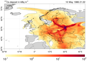
FALL3D is an open source community code for atmospheric transport of particles, aerosols and radionuclides particularly targeting volcanological applications. During the first phase of the ChEESE Center of Excellence (ChEEE-1P, 2018-2022), the pure MPI version of the code was heavily refactored and accelerated using OpenACC directives, and a dwarf version (mini-app) implemented to facilitate co-design and performance improvement activities.
 
FALL3D solves the so-called Advection-Diffusion-Sedimentation (ADS) equation on a generalised orthogonal system of coordinates. Coordinate mappings exist to map physical domains (e.g. accounting for Earth’s curvature and topography) to a «brick-like” computational domain by using coordinate-dependent horizontal and vertical mappings. The model can be solved on various horizontal (cartesian, spherical, Mercator, polar stereographic, etc.) and vertical (terrain following, etc.) coordinate systems. The finite volume based solver uses a high-resolution Kurganov-Tadmor (KT) scheme combined with an explicit solver time marching (4th order Runge-Kutta or first order Euler) and considering a simple structured mesh with 3D brick-like domain decomposition. FALL3D uses MPI for 3D domain decomposition with freedom for users to choose the number of processors along each spatial direction. The «brick-like» computational domain is discretised using a variation of the staggered Arakawa-D grid, in which the wind velocity components are evaluated at the respective cell faces and the rest of scalar quantities at the cell centres. This configuration is very convenient for solving the 3D equation in a fractional manner because, when solving each one-dimensional case, wind velocities are already aligned with the boundaries of the corresponding one dimensional cells. In the accelerated version (currently relying on OpenACC + CUDA-aware MPI) each subdomain is assigned to a single GPU.
 
The main repository has obtained an EOSC-synergy software gold badge 
 

Cite: Prata, A. T., Mingari, L., Folch, A., Macedonio, G., and Costa, A.: FALL3D-8.0: a computational model for atmospheric transport and deposition of particles, aerosols and radionuclides – Part 2: Model validation, Geosci. Model Dev., 14, 409–436, https://doi.org/10.5194/gmd-14-409-2021, 2021.

PyVOLCANS

PyVOLCANS is an open-access Python tool that generates data-driven sets of analogue volcanoes for any Holocene volcano listed in the Global Volcanism Program (GVP) Volcanoes Of The World database (v. 4.6.7), based on the VOLCANS (VOLCano ANalogues Search) method presented by Tierz, Loughlin and Calder (2019).

The main goal of PyVOLCANS is to help alleviate data-scarcity issues in volcanology, and contribute to developments in a range of topics, including (but not limited to): quantitative volcanic hazard assessment at local to global scales; investigation of magmatic and volcanic processes; and even teaching and scientific outreach.

PyVOLCANS provides its users with full flexibility to identify customised sets of analogue volcanoes, by exploring three main variables:

1. Target volcano (or volcano of interest);
2. Weighting scheme (i.e. set of weights given to each of the five volcanological criteria to calculate multi-criteria, total analogy);
3. Number of ‘top’ analogue volcanoes (i.e. those with the highest value of analogy with the target volcano).

In addition, PyVOLCANS allows the user to compare the values of total analogy computed for ‘a priori analogues’ (i.e. volcanoes thought to be good analogues to the target volcano by other strands of evidence, e.g. expert knowledge) with those computed for the rest of volcanoes in the GVP database. This permits investigation of sets of analogue volcanoes for varied purposes, and makes PyVOLCANS a useful complementary method to expert-derived analogue volcanoes.

GitHub repository: https://github.com/BritishGeologicalSurvey/pyvolcans  
PyPI project: https://pypi.org/project/pyvolcans/ 

Cite: Tierz, P., Christodoulou, V., Stevenson, J.A., Loughlin, S.C. (2021). PyVOLCANS: A Python package to flexibly explore similarities and differences between volcanic systems. Journal of Open Source Software, 6(68), 3649. https://doi.org/10.21105/joss.03649

SSTAR

SSTAR (Subtle Surface Thermal Anomalies Recognizer) is a user-friendly software framework designed to detect and analyze subtle, spatially distributed thermal anomalies at active volcanoes and hydrothermal systems using satellite thermal infrared observations. Unlike conventional satellite-based approaches that primarily target high-temperature, localized features such as lava flows, domes, or active vents, SSTAR is specifically designed to identify low-amplitude thermal variations—often on the order of ~1 K—distributed over areas of several square kilometers and evolving over months to years.

SSTAR uses thermal infrared observations acquired by the MODIS instruments aboard NASA’s Terra and Aqua satellites. The framework evaluates variations in the brightness temperature of user-defined regions of interest relative to a reference area, allowing spatially coherent environmental variability to be reduced and subtle thermal changes to be isolated. The workflow integrates the main processing steps required for long-term thermal analysis, including cloud filtering, temporal aggregation, interpolation, denoising and low-pass filtering, uncertainty quantification, and visualization of the resulting thermal anomaly time series and their spatial distribution.

The software is designed to make the analysis of diffuse thermal anomalies transparent, reproducible, and accessible to both researchers and volcano-monitoring institutions. Through its graphical user interface, users can define target and reference regions, select processing parameters, evaluate their influence on the retrieved signals, and generate standardized outputs without having to develop dedicated satellite-processing routines. SSTAR therefore complements existing hotspot-based thermal monitoring approaches by providing a framework specifically tailored to the investigation of subtle and persistent thermal unrest.

SSTAR results for selected volcanoes are also updated daily and made openly available in near real time through the SSTAR monitoring platform (https://sstar.geo3bcn.csic.es/) hosted at Geosciences Barcelona–CSIC, with the goal of supporting operational volcano monitoring and alert-level assessments.

Software: Girona, T., & Brenot, L. (2026). SSTAR – Subtle Surface Thermal Anomalies Recognizer. In Earth, Planets and Space [Computer software]. Zenodo. https://doi.org/10.5281/zenodo.21497700

Near-real-time results: SSTAR monitoring platform (https://sstar.geo3bcn.csic.es/)

Cite: Girona, T., Brenot, L. SSTAR: a user-friendly framework for detecting and monitoring subtle thermal precursors to volcanic eruptions—application to Shishaldin, Alaska. Earth Planets Space 78, 166 (2026). https://doi.org/10.1186/s40623-026-02497-6